 |
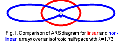
The most common form of azimuthal resistivity survey visualization is polar ARS diagram (fig.1). Apparent resistivity value along definite azimuth is drawn on this diagram as the point at the distance from the diagram's center along the same azimuth with definite linear scale. All point are connected with a curve (fig.1). For linear array this diagram is really ellipse while for non-linear arrays this diagram represents more complicated figure. Above inhomogeneous models ARS diagrams have usually more complicated form then ellipse. Sometimes cartesian form of ARS diagrams' display is applied (fig.2). | 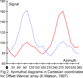 |
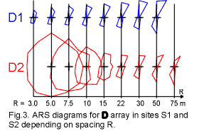 |
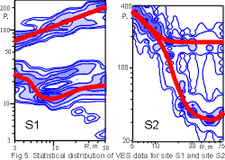
Azimuthal sounding results can be visualised in several forms: as group of azimuthal diagrams, each for separate distance (fig.3); as polar map with array distance values R measured along each azimuth with apparent resistivity isolines (fig.4); as vertical electrical sounding curves for each azimuth or their representation as statistical distribution of probability density in logarithmic co-ordinate system: apparent resistivity - array distance (fig.5). | 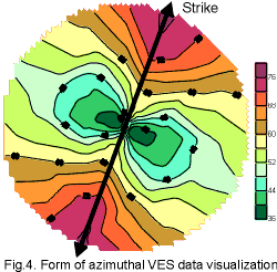 |
 |
Each form has its good and bad sides and the best way is in using all of them. |
V.A. Shevnin, I.N. Modin
Tel. & fax: (7-095) 939 49 63
E-mail: sh@geophys.geol.msu.ru
Please feel free to send us your comments.
![]()
![]()
![]()